

Storm Austen Ireland start time as Met Eireann forecast worst areas hit
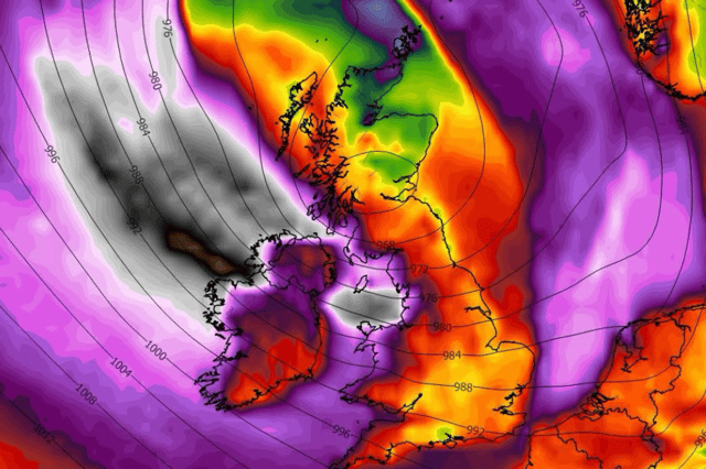

Met Eireann is warning ‘cyclonic variable winds’ will hit the country hard as Storm Austen heads our way
Storm Austen will hit Ireland on Thursday according to Met Eireann with its effects lasting for 13 hours before easing off.
An alert for the first named storm of the year was officially activated by UK’s Met Office before being confirmed in Ireland.
A yellow rain warning is in place for the whole country from Thursday at 7pm until Friday at 8am with counties along the coast in the west and southwest being hit hardest according to early indications.
Met Eireann warn “heavy rain associated with Storm Austen will spread eastwards across the country” leading to “difficult travelling conditions, localised flooding possible and outdoor events being cancelled”.
The National Forecaster is warning that “cyclonic variable winds” will come in hard with Storm Austen on Thursday night bringing with it severe thunderstorms as flooding and disruption expected.
Here’s the full Met Eireann weather report on Storm Austen for the rest of the week:
Today: “Wednesday will begin rather wet and windy, especially over much of the north and east, with overnight rain largely confined to east Ulster by late morning. Sunny spells and scattered showers will follow from the west, some heavy, especially this evening. A blustery day, in a fresh to strong and gusty northwest wind, later easing. Cool with highest temperatures of 9 to 13 degrees.
“Scattered outbreaks of thundery rain with isolated thunderstorm will occur early tonight, clearing northeastwards overnight. Drier, clearer but colder weather will follow later. Lowest temperatures of 0 to 7 degrees, coldest away from west and southwest coasts; all in a light southwest or variable breeze.”
Tomorrow - Storm Austen starts: “Starting mostly dry with sunny spells and well scattered showers across the west and north on Thursday. However, very heavy rain will develop in the southwest during the afternoon, extending northeastwards during the evening hours. Localised flooding is possible, especially in Munster and Leinster. Light to moderate east to northeast winds will strengthen later too. Very wet and windy across southern counties during the evening. Highest temperatures of 10 to 14 degrees.”
“Thursday night will be extremely wet and windy, and potentially stormy in the southeast. Widespread heavy and persistent rain will affect much of the country with some flooding expected. Isolated thunderstorms will occur too. Cyclonic variable winds will veer northwest and further strengthen overnight, reaching gale force in places. Lowest temperatures of 5 to 8 degrees.”
Storm Austen ends at 8am: “On Friday, lingering wet and windy weather will clear eastern counties by around mid-morning. Sunshine and well scattered blustery showers elsewhere will follow for the rest of the day, mainly affecting western counties. Highest temperatures of 9 to 13 degrees. Fresh and gusty northwest winds will moderate before evening.
“Friday night will be largely dry and clear early on. However, wet and rather windy weather is expected to move in from the west later in the night. Lowest temperatures of 3 to 8 degrees. Westerly winds will back southerly and freshen, with strong and gusty winds near south and west coasts.”