

Met Eireann forecast coldest temperatures yet after weather warning ends
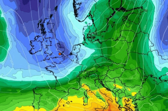

It will be the first time this season that temperatures will plunge into minus territory after the 12 hour alert finishes
Met Eireann has forecast some of its coldest weather yet for Ireland this season as temperatures are set to hit subzero across the country.
An eight county weather warning for fog will deactivate after 10am on Tuesday leading to a dry day with good spells of sunshine over Ireland.
All of Connacht, Cavan, Donegal and Monaghan were put under the 12 hour alert from 10pm on Monday night with difficult travelling conditions and poor visibility warned.
Once clear, temperatures will rise to around 12C with the chance of an odd shower here and there before a bitter nighttime.
Temperatures will dip to -1C overnight with a mix of cloud and clear spells alongside some fog and mist forming.
The west will be the coldest it has been all year but there'll be a little bit more of a moderate east to northeast breeze in eastern and some southern counties, which means it won't be as cold in those areas.
Here’s the full weather outlook for the week:
Overview: “High pressure will continue to be in control of our weather for the rest of the week and indeed probably the weekend too, so it'll be settled and largely dry, with just some well scattered showers. There'll be a bit more of an easterly breeze for a time, helping to limit fog and frost. Into Friday and the weekend the winds may ease light again, so probably a bit colder, with more in the way of fog and frost possible once again.”
Wednesday: “Tomorrow, any frost and fog will gradually clear through the morning and early afternoon, to leave a mainly dry, bright day with plenty of sunshine. It'll be a little cloudier at times with a few light showers, especially in the south and parts of the east. There'll be a bit more of a breeze compared to the previous couple of days, with easterly winds increasing mostly moderate, fresher though in the south and parts of the east. Cool with highest temperatures of 9 to 12 degrees.”
Wednesday Night: “Apart from the odd isolated light shower in the east and south, it'll be a dry night with clear spells. There'll be less mist and fog around as compared to the previous couple of nights, with just isolated mist and fog patches expected further west, as there'll be a bit more of an easterly breeze. Lowest temperatures of around 0 to 6 degrees generally, with some frost under clear spells. It'll be less cold in eastern counties and in southern coastal parts. Winds will be light to moderate easterly, a little fresher at times in eastern and southern coastal parts.”
Thursday: “While there'll still be bright or sunny spells on Thursday, the best of these further west, there'll be more in the way of cloud around compared to the earlier days of the week. While predominantly dry conditions will persist, some well scattered showers will feed in from the east at times. Highest temperatures of 9 to 12 degrees and feeling a bit colder than that in mostly moderate easterly winds, fresh and occasionally gusty in eastern coastal parts.”
End of the week: “Friday will once again bring plenty of dry weather, with just some well scattered showers expected. While there's likely to be a good deal of cloud, there'll be some bright or sunny spells, the best of these further west. Highest temperatures once again of 9 to 12 degrees in light easterly winds.”