

Met Eireann confirm Storm Boelo to follow Austen as second weather event for Ireland this weekend
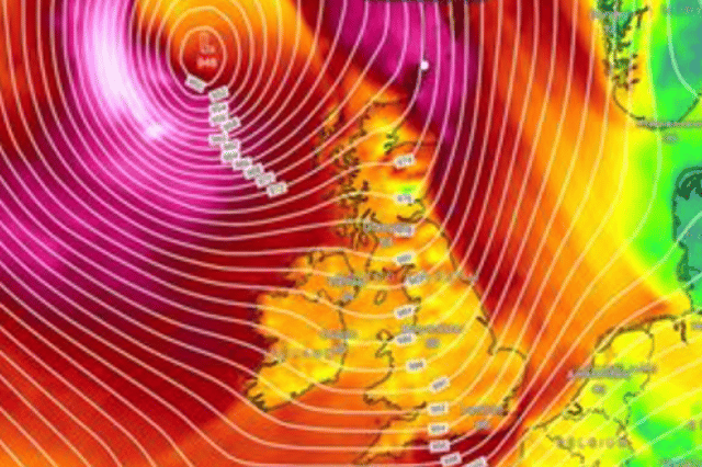

Several warnings are expected for Storm Boelo which will follow just hours after Storm Austen fades away
Met Eireann has shared the Met Office’s confirmation that a second Storm Boelo will follow Storm Austen this weekend.
The second named storm in 36 hours is set to track the northwest and west of Ireland on Saturday bringing strong winds and heavy rain with several warnings expected.
These warnings are expected to take over from around Friday evening and night onwards and into Saturday day and afternoon.
Ahead of Storm Austen tonight, several new warnings have been issued by Met Eireann as “cyclonic variable winds will veer northwest and further strengthen overnight”.
A yellow wind and rain warning is in place for the whole country from 7pm Thursday until 10am on Friday with Met Eireann warning “heavy rain associated with Storm Austen will spread eastwards across the country. Strong easterly winds will back northwesterly and strengthen further, especially in the south and southeast”.
The National Forecaster is expecting areas all over Ireland to experience: Difficult travelling conditions; localised flooding possible; outdoor events impacted; debris and loose objects displaced as well as fallen trees and branches.
There is also two status orange weather warnings in place for counties with a rain warning issued for Cork, Kerry and Waterford until 5am Friday and the same for Dublin, Wexford and Wicklow from 2 until 8am.
Met Eireann’s full Storm Austen warning reads: “Starting mostly dry with sunny spells and well scattered showers across parts of the southwest, west and north today. However, the afternoon will turn rather wet and windy as Storm Austen tracks to the south of Ireland, with very heavy rain developing in the southwest, extending northeastwards by the evening. Localised flooding is possible, especially in Munster and Leinster. Light to moderate east to northeast winds will strengthen fresh to strong. Highest temperatures of 10 to 14 degrees.”
They continued: “Tonight will continue wet and windy with widespread heavy rain associated with Storm Austen affecting much of the country. Some flooding is expected across southern and eastern counties. Isolated thunderstorms will occur too. Cyclonic variable winds will veer northwest and further strengthen overnight, reaching strong gale force along southern coasts. Lowest temperatures of 4 to 8 degrees.”
Here’s how Friday will look after Storm Austen: “Any lingering rain will clear eastern counties by around mid-morning. Sunshine and well scattered blustery showers elsewhere will follow for the rest of the day, mainly affecting western counties. Highest temperatures of 9 to 13 degrees. Fresh and gusty northwest winds will gradually ease to moderate towards evening.”