

Met Eireann forecast update shows 'curveball' weather event to hit Ireland
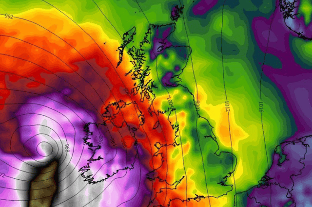

Several weather experts are seeing the same thing
Met Eireann has updated its forecast after weather experts have warned that a possible ‘curveball’ weather event could hit Ireland next week.
Several experts have said that there could be the possibility of stormy conditions on Tuesday but also added that it was currently too far out to be certain at the moment.
One expert said: “The ECMWF model has thrown a curveball for next Tuesday with the possibility of a storm coming up from the south. The GFS model however is showing a low bringing some gusty winds up but no indication of a storm. I'll continue to monitor it with updates. It is still too far out to be certain.”
At the moment Met Eireann has updated its forecast to say that “low pressure will remain dominant next week” bringing with it “wet and blustery conditions at times” but that’s the extent of what they’re seeing so far.
Wednesday morning will see rain and cloud lingering in the east and south but leaving early on bringing a dry and bright day with sunny spells and the odd shower.
Temperatures of 19C during the day will drop to around 7C overnight with clear spells as cloud builds from the west leading to some rain and drizzle by morning.
Here’s Met Eireann’s weather forecast for the rest of the week:
Overview: “A brighter day on Friday but it will become more unsettled this weekend with rain and breezy conditions at times. Daytime temperatures will be in the mid to high teens.”
Tomorrow: Thursday will be a breezier day with moderate to fresh southerly winds developing. A mostly dry start to the day with sunny spells in the east. However, it will be cloudier elsewhere with patchy rain and drizzle. Cloud will thicken across the country through the day with more persistent rain spreading over the western half of the country by evening. Highest temperatures of 15 to 19 degrees.”
Thursday night: “Cloudy at first with rain and drizzle spreading eastwards. Rain will clear from most areas overnight, though patches of light rain and drizzle will linger in parts of the south and east until morning. Southwesterly winds will ease light to moderate. Lowest temperatures of 9 to 13 degrees.”
Friday: “Lingering drizzle in the east and south will clear early on Friday to leave a brighter day with a mix of sunny spells and scattered showers. Highest temperatures of 14 to 17 degrees in moderate southwest winds.”
Friday night: “A dry night for many with clear spells, though scattered showers will continue in Atlantic coastal counties. Lowest temperatures of 10 to 14 degrees in moderate southwest winds, fresher on northwest coasts.”