

Weather expert warns possible 'big storm' hitting Ireland as Met Eireann issue update

They said it’s not a guarantee but it is definitely very much one to watch
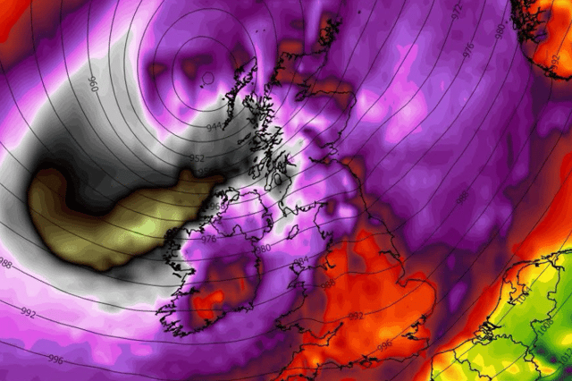
One weather expert has warned of the possibility of what they describe as a ‘big storm’ hitting Ireland before October is out.
After a week of weather warnings for the west, something more sinister could strike Ireland at the Bank Holiday weekend.
Popular amateur weather forecaster Donegal Weather Channel is warning of possible stormy conditions on Monday October 26.
The channel said: “The ECMWF is showing high pressure from Friday up until the 21st this morning on the 0z run and then shows this big storm hitting on the Bank Holiday Monday 26th October.
“This is only on run but interestingly the GFS ensembles hint at a deep low around the same time. At this moment it's one to watch and not a guarantee. I will continue to monitor and update on any changes.”
Despite not forecasting that far out yet, Met Eireann did say that their further outlook forecast shows “uncertainty” but that a low pressure will return with spells of wet and windy weather.
Here’s how the weekend weather is looking:
Friday: “A mix of sunshine and showers today. The showers will be most frequent in the west this morning, with some turning heavy, and a slight chance of thunder in the north. During the afternoon, the showers will become mostly confined to Ulster and Leinster before dying away later to leave a dry and bright evening. Highest temperatures of 10 to 14 degrees, with light to moderate northwesterly winds.
“Tonight will be dry for most with long clear spells, and just the odd light shower possible in northern parts early on. Lowest temperatures of 1 to 5 degrees, with a touch of frost in places. Some mist and fog patches will also form in a light northwesterly or variable breeze.”
Tomorrow: “Any mist and fog patches will clear tomorrow morning to leave a dry, bright and crisp day with plenty of sunshine. Highest temperatures of 10 to 13 degrees with light northeasterly or variable breezes.”
Saturday night: “Dry and chilly with patches of mist and fog forming under mostly clear skies in just a light variable breeze. Lowest temperatures of 1 to 5 degrees, possibly reaching freezing locally, with some frost developing.”
Sunday: “Mist and fog will clear through the morning to a leave a dry day with plenty of sunshine. Highest temperatures of 10 to 13 degrees with light variable breezes.”
Sunday night: “Another dry, chilly night with mostly clear skies and light variable breezes allowing patches of mist and fog to form. Lowest temperatures of 1 to 6 degrees.”