

Met Eireann weekend forecast shows 20C day before 'possible major weather event'
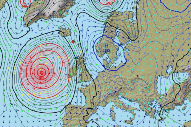

Carlow Weather’s Alan O’Reilly, who has previously been first to the biggest weather events in Ireland in the past few years, is one of the weather experts who is tracking this possibility
Met Eireann’s updated weather forecast for the weekend shows a 20C day hitting the country before a possible major weather event at the start of next week.
Saturday will see highs topping the 20C mark across the country but some weather experts are still warning that a ‘strong risk of storm’ is possible on Tuesday.
Carlow Weather’s Alan O’Reilly, who has previously been first to the biggest weather events in Ireland in the past few years, is one of the weather experts who is tracking this possibility.
He said: “Still a lot of uncertainty around risk of storm early next week. Again the ECMWF model brings it into Ireland and strong enough into Southwest but GFS model has it peaking well South of Ireland. I’m sure you will see worst case scenario charts shared so bear in mind still very uncertain.”
Friday will be a bright day for many counties but rain and drizzle will linger in the south and east before clearing. The afternoon will be a mix of sunny spells which will turn hazy at times with the odd isolated shower. Temperatures of 18C will dive to 9C overnight leading to some occasionally heavy showers in the west.
Here’s the weekend forecast in full from Met Eireann:
Overview: “Changeable weather over the next few days. Becoming more unsettled into Tuesday and for the rest of the week.”
Tomorrow: “Plenty of dry and bright weather tomorrow with a mix of sunny spells and isolated showers, the east seeing the best of the dry spells. More frequent showers will develop in the west and northwest later. Breezy with moderate to fresh south to southwest winds. Highest temperatures of 15 to 20 degrees.”
Saturday night: “Clear spells to start the night. Cloud will build overnight with rain developing in western and southern areas, turning heavy at times and extending northeasterly. Lowest temperatures of 11 to 13 degrees in moderate to fresh southerly winds.”
Sunday: “Generally cloudy on Sunday with outbreaks of rain for many, possibly turning heavy in some places. The rain will clear northeastwards to scattered showers and sunny spells by the afternoon. Highest temperatures of 14 to 18 degrees with moderate to fresh westerly winds.”
Sunday night: “Plenty of clear spells with outbreaks of rain and drizzle on western fringes overnight. Lowest temperatures of 6 to 10 degrees in light southwesterly breezes.”