

Met Eireann weather u turn as forecast update for the week shows 20C day
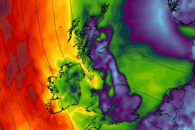

There had been speculation about a possible storm risk but it looks like the complete opposite could happen now
Met Eireann’s updated forecast for the week shows a weather u-turn with a 20C day promised after speculation about a possible storm risk.
Last week it was predicted that Ireland could see its first storm of the season on Tuesday but in fact the complete opposite is now forecast.
Tuesday will see one of the nicest days of the month as the dial hits the 20C mark but it will be followed by thundery spells across Tuesday night and into Wednesday so we’re not out of the woods just yet.
Monday will be dry and bright for most of the day with spells of sunshine turning hazy at times with isolated showers.
Temperatures of 17C will drop to 9C overnight but will remain dry with clear spells as rain and drizzle sprinkles across parts before a fresh morning heading into that beautiful Tuesday day.
Here’s how the rest of the week looks weather wise:
Overview: “Unsettled and blustery at first with rain and heavy showers. Likely turning more mixed through the week.”
Tuesday: “Tomorrow will be windy with southeasterly winds increasing fresh to strong and gusty, and reaching near gale force in the afternoon and evening. Some early bright spells in the north but cloudy elsewhere with patchy rain and drizzle. A mild and humid day with highest temperatures of 17 to 20 degrees.”
Tuesday night: “Rain will clear northeastwards to scattered showers and clear spells from the southwest early on. The showers will be heavy, blustery and possibly thundery at times, especially in the south and west. Strong to near gale southeasterly winds will veer southerly with the clearance of the rain and ease moderate to fresh, stronger near coasts. Lowest temperatures of 10 to 14 degrees.”
Wednesday: “Blustery with sunny spells and widespread showers, some heavy and thundery. Highest temperatures of 15 to 18 degrees in fresh southerly winds, stronger near western coasts.”
Wednesday night: “Winds easing and turning drier for most as showers become confined to the west with plenty of clear spells. Lowest temperatures of 8 to 12 degrees in mostly light southerly breezes.”
Thursday: “Dry for many with sunny spells and scattered showers. A spell of more persistent rain is likely to move into the west later in the day. Highest temperatures of 14 to 17 degrees in moderate, occasionally fresh, southwest winds, backing southerly later.”