

Galway weather update as Met Eireann forecast big change after 24C spike
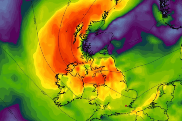

The forecast for the weekend is not looking good
Met Eireann is forecasting a major change in the weather after today with temperatures on Thursday set to be the highest for a while.
Carlow, Kilkenny, Wexford, Wicklow, Cork and Waterford will have yellow rain weather warnings in place from 12pm today until 3am tomorrow with the rest of the country set to miss out on the worst.
The National Forecaster is saying that the dial will move as high as 24C on Thursday and that sunny spells will break in before heavy thunderstorms in the evening.
This morning will start off dry in most spots with the odd bit of mist and fog. Outbreaks of rain will scatter across the east, south and midlands in the morning with the west missing out until later in the day.
Again the night time will be the driest in the west, for once, with rain covering much of the rest of the country and turning heavy and thundery in places as temperatures stay around the mid teens mark.
Here’s how the first glimpse of the weekend weather is looking:
Friday: “Tomorrow, areas of mist and fog, and any lingering rain in the east, weather will clear through the morning. Becoming a bright day for most with sunny spells and scattered showers. Highest temperatures of 18 to 23 degrees, coolest in the northwest, with light, occasionally moderate, northwest breezes.”
Friday night: “Dry for most at first. Outbreaks of rain in the southwest will gradually extend over much of the country through the night, though northern areas may remain dry overall. Lowest temperatures of 12 to 16 degrees with mostly light variable breezes and some patches of mist and fog.”
Saturday: “A wet start for most with rain continuing. It will gradually clear eastwards through the morning and early afternoon with drier and brighter weather following. Highest temperatures of 16 to 21 degrees with light northerly breezes becoming westerly.”